Height Fields Using Shaders
Height Fields Using Shaders
Pranav Rathod
Date: February 21, 2024
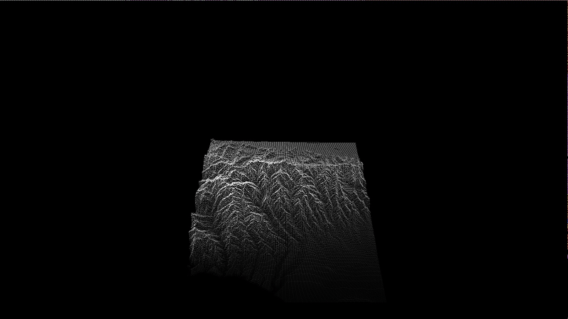
For this project, I created a program that utilizes OpenGL’s core profile to generate and manipulate a 3D height field from user-specified image data. The grayscale values of the image are interpreted as elevation, rendering the height field as a visually stunning terrain. I also implemented advanced transformation controls, smooth shading, and interactive rendering modes to enhance user experience.
Source Code
If you’d like to explore the source code for this project, you can find it on my GitHub repository: https://github.com/pranavsrathod/Height-Fields/.
Project Overview
This project provided an opportunity to explore shader programming and 3D graphics using OpenGL. The application reads grayscale image data to construct a height field, where pixel intensity determines the elevation. Key features include:
- Render Modes:
- Point Rendering (
1): Displays the height field as individual points. - Wireframe Rendering (
2): Uses lines to give a skeletal view of the terrain. - Solid Rendering (
3): Renders the height field as a continuous surface of triangles.
- Point Rendering (
- Transformation Controls:
- Rotate: Use the mouse to rotate the model along different axes.
- Scale: Hold
Shiftand use the mouse to scale the model up or down. - Translate: Hold
tand use the mouse to move the model across the plane.
- Smoothing Mode:
Press4to activate a smoothing shader that refines the terrain geometry and color. Adjust terrain scale with the+and-keys and modify color intensity with the9and0keys. - JetColorMap:
The vertex shader transforms grayscale colors into a vibrant colormap with dynamic adjustments via exponents.
Citations
Special thanks to the following resources for their insights and examples:
- OpenGL Tutorials by the Khronos Group.
- WebGL documentation for understanding shader programming and rendering pipelines.
- Grayscale image processing examples for 3D height field generation.